Supporting effective mangrove management in the Red River Delta
Mangrove forests cover thousands of hectares of coastline in many of the world’s tropical and sub-tropical countries. As well as supporting the livelihoods of people who live and work near the forests, the trees play a significant environmental role, protecting the coastline from storm surges during extreme weather. Mangroves are also important for carbon storage, helping to regulate climate change.
But the forests are under increasing threat from economic growth. In Brazil, for example, a large harbour development proposed in the Amazon Delta will require significant areas to be cleared, while in Tanzania, tourism is responsible for mangrove trees being cut down to make way for sea view hotels.
Understanding how mangroves support local economies, but also how these forests have changed over time in both the density and quality of the vegetation could provide valuable information to help manage these important resources.
Teaming up with Vietnamese partners
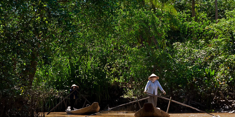
At the University of Leeds, researchers in the School of Earth and Environment have teamed up with experts from the Vietnam National University (VNU), the Hanoi National University of Education (HNUE), and the Vietnam National Space Centre (VNSC) to investigate mangroves in Vietnam’s Red River Delta, where many sites are being cleared to make way for large scale aquaculture.
“In the Red River Delta, a key challenge is in the management of these forests,” explains Professor Claire Quinn, who is leading the project. “The land is cleared to make way for aquaculture, such as clam and shrimp farming. These activities usually aren’t done by local people – instead, investors export most of the seafood overseas and as soon as there’s problem, a disease infestation, for instance, they abandon the land and move on. But because they still own the land rights, there’s no opportunity for the locals to access the land and start restoring the mangroves.”
In a three-year project funded by the Newton Fund and the Economic and Social Research Council, the team will use remote sensing data supplied by the VNSC to map changes in vegetation density over the past 25 years. Researchers in Leeds will also review published data on mangrove forests and compile a set of indicators to assess the varying quality of the vegetation over time.
Alongside this, researchers from HNUE will be working ‘on the ground’ to validate the remote sensing data through ecological analysis. The teams will also work with local communities to look at the relationships between mangroves and livelihoods and try to better understand how both forests and people contribute to a socioecological system in which each is supported by the other.
The project is underpinned by earlier work done at the University of Leeds led by Professor Lindsay Stringer, alongside colleagues in Vietnam, Brazil and Tanzania. This enabled the fundamental research questions to be outlined and also established the partnerships with Vietnamese research institutions that set the stage for the work to go ahead.
Gathering evidence to influence policy
The evidence gathered through the project will provide a picture of how the mangroves deliver essential services to communities, how the forests have changed in the past and are likely to change in the future and what impacts these changes might have on local communities and ecological systems. It will help regional governments understand, for example, where there might be critical areas for storm protection that should be considered when planning development in mangrove areas, or if mangroves are cleared, how that might affect the economy at a local level.
“As well as mapping how they have changed over time, we want to build a picture of what sort of mangrove areas local people would like to see in the future,” says Professor Quinn. “And then we need to figure out what we need to do to get to that point – do we need to change protected area boundaries, do we need changes to land rights, or large-scale reforestation programmes to make the mangroves more sustainable?”
“We hope that the evidence we gather will be robust enough to inform policy in the area and help NGOs and other groups to better understand where to focus their resources,” says Professor Stringer.
“Our ultimate aim is to develop a Geographic Information System-based tool that will enable policy makers to try out different scenarios for development and conservation in the area that will help them to understand the effects of different approaches to managing the mangroves. This will lead to a more balanced consideration of how human decisions about the mangroves affect the ecosystem services – the carbon storage and environmental protection – and also could guide more sustainable livelihoods for the communities that rely on the forests.”
She added: “Mangroves are important to more than 120 countries around the world and so the approaches that we’re developing in Vietnam could also have a much wider significance than solely in the Red River Delta.”
The team also has plans to link their project to work being carried out by research groups from other institutions which looks at the effects of hydrology, sedimentation, and other environmental influences on mangrove forests.
“There are other factors, like damming upriver, or changes in the amounts of sediment in the rivers that might also pose future risks to the mangroves,” says Professor Quinn. “Being able to model these factors and show how they might affect both pristine and more degraded areas of mangrove could be critical in planning how to manage the forests effectively.”
Policy briefings
The project has informed a number of policy briefings about harnessing multiple benefits from resilient mangrove systems. These are designed to inform policy decisions and action on the ground.
Biophysical mapping of mangroves: a key component to management and sustainable use of mangrove resources.
Social values for ecosystem services: benefits to households in the Red River Delta.
WebGIS mangrove geographic information system: an important tool for management and sustainable use of mangrove resources.
Insights from scenario evaluations: possible future scenarios for the year 2040
Image: “Women at work” by Jonas Hansel is licensed under CC BY-NC-SA 2.0