True size of world’s largest tropical peatland revealed for the first time

A new study has mapped the full scale of a vast region of peatland in the heart of the Congo Basin, revealing it to be 15% bigger than previously thought.
The international partnership of UK and Congolese scientists, has found that the peatlands span 16.7 million hectares, equivalent to the size of England and Wales combined. This includes 1 million hectares slated to be auctioned for oil development by the DRC government next week.
Led by the University of Leeds in the UK and the University of Kisangani in the Democratic Republic of the Congo (DRC), the researchers spent three years visiting scientifically unexplored swamp forests in the DRC.
For the first time, the researchers have shown extensive peatlands in DRC, with peat up to six and a half meters deep. Their findings, published today in Nature Geoscience, show that the peatlands in the central Congo Basin store between 26 and 32 billion tonnes of carbon – roughly the equivalent to three years’ worth of global fossil fuel emissions.
The central Congo basin is home to 36% of the world’s tropical peatland area, and stores 28% of the world’s tropical peat carbon, according to the new study.
However, the researchers show that only 8% of this peat carbon lies within nationally protected areas, suggesting vulnerability to future changes in land-use.
The critical importance of keeping this carbon safely stored in tropical peatlands cannot be underestimated in the battle to tackle climate change.
Bart Crezee, lead author and postgraduate researcher at Leeds’ School of Geography, said: “Our findings really highlight the importance of the Congolese peatlands as a globally important store of carbon.
“As much carbon is stored in this relatively small area of peatland as is found in all the trees of the entire Congo Basin rainforest. The critical importance of keeping this carbon safely stored in tropical peatlands cannot be underestimated in the battle to tackle climate change.”

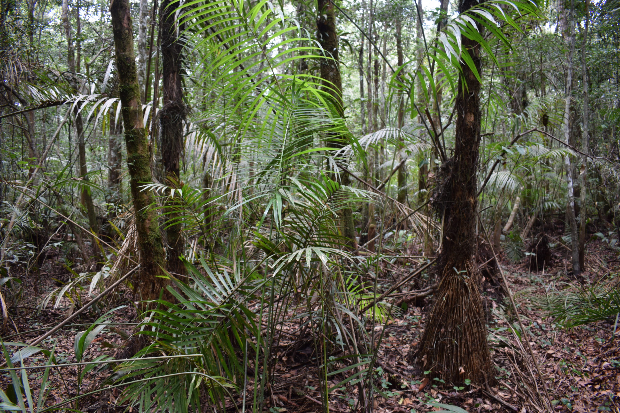
A peat swamp forest along the Ikelemba River in DRC during the dry season. Credit: Bart Crezee
Mapping the peatlands
The central Congo peatlands were first mapped in a 2017 study also conducted by a UK-Congolese team. Then the scientists spent three years in the neighbouring Republic of Congo (RoC) and predicted the peatlands to cover an area equivalent to the size of England.
However, two-thirds of the predicted area of peatland was located in the DRC, where no fieldwork had taken place until now.

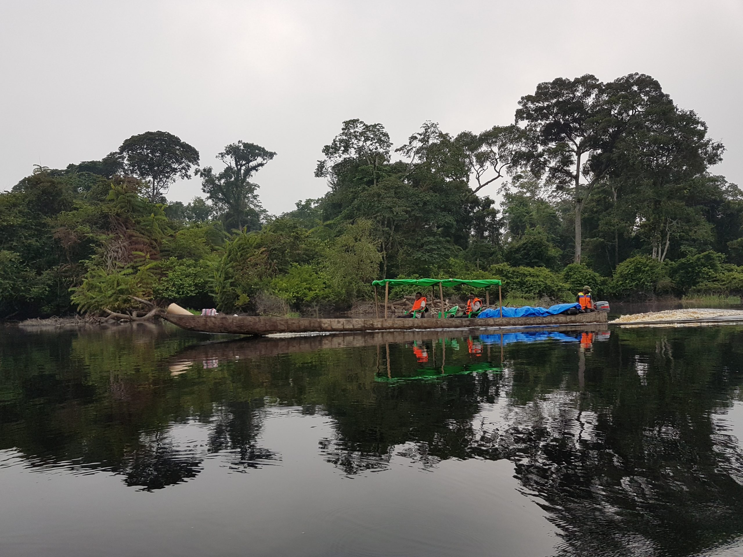
Part of the research team travelling in a dugout canoe on the Ruki River in DRC. Credit: Bart Crezee
Mr Crezee added: “The 2017 study provided us with a great foundation for this next phase of research, but we needed to trek into remote peatlands in DRC to sample peat and assess if Central Africa really hosts the world’s largest tropical peatland. It certainly does, and the peatland complex is even larger than we thought back in 2017.”
“After years of work we have hundreds of field measurements of peat depth from across the region which has allowed us to create the first ever maps of how deep the peat is, how much carbon they store, and an accurate map of the largest tropical peatland in the world.”
“We are providing essential information, as the world needs to know where the carbon is stored in order to protect it.”
The researchers worked with 18 villages across both the DRC and RoC involving over 100 field assistants and local guides. This collective effort allowed the scientists to make 463 measurements of peat depth across the Congo Basin to estimate how much carbon is held in the Central Congo peatlands.
The researchers used satellite data to predict peat depth in areas where there were no measurements. Combining the peat depth estimates with peat carbon content from peat samples allowed the researchers to calculate the total amount of carbon stored across the region.

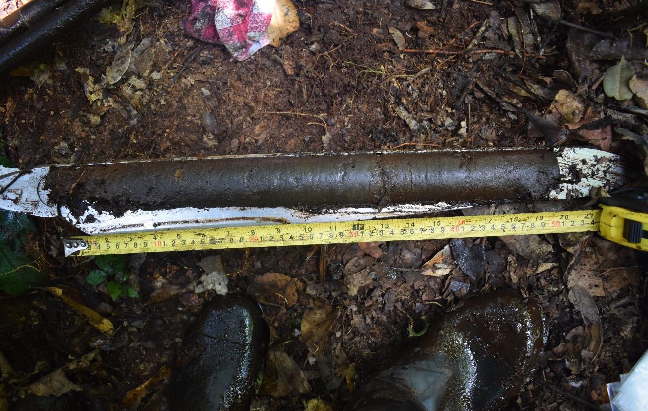
The top 50 cm of a peat core collected by the research team. Credit: Bart Crezee
The scientists found that many peatlands in the DRC are located in narrow river valleys along the Congo River’s tributaries, in contrast to the wide expanses of peat found between rivers in the RoC.
Mr Crezee said: “To our surprise, the peat in the narrow river valleys of the DRC is at least as deep as in the wider basins in the Republic of Congo. In the DRC you’ll find a five metre deep layer of peat just four or five kilometres into the swamp. But in the Republic of Congo, you only find a peat layer of five metres deep after trekking over 20 kilometres into the swamp.”
Protecting the peatlands
Peat is partially-decomposed plant matter. This wetland soil is more commonly found in cool environments, but the year-round waterlogging in the swamp prevents decomposition. This means that when trees, leaves and roots die, they do not fully rot away and slowly form a layer of peat.
The peat acts as a carbon sink, removing carbon from the atmosphere though past plant growth.
If peatlands dry out, either through changes in land use such as drainage for agriculture or reduced rainfall, peat decomposition can accelerate, releasing the stored carbon into the atmosphere.
The central Congo peat swamp forests are currently one of the most carbon-dense ecosystems on earth, storing an average of 1,712 tonnes of carbon per hectare in peat.
Due to their remote location, the peatlands in the Congo Basin so far have been kept wet because they are relatively undisturbed. Development on the peatlands could have a disastrous effect on managing global climate change.
Parts of the peatlands have been earmarked for oil exploration, as well as planned industrial logging concessions and palm oil development, placing the future of the area under threat.
When the researchers overlaid the new peatland map with plans for changes in land use, they found that a quarter of the carbon stock is threatened by industrial logging, mining or palm oil development.
People living near the peatlands are using them fairly sustainably, but threats are growing from oil drilling, logging and palm oil plantations.
Professor of Botany of Forest Conservation at the University of Kisangani Corneille Ewango said: “The Congolese peatlands are so rich. At one site alone we counted more than one hundred plant species, some of which are almost certainly new to science.
Prof Ewango continued: “People living near the peatlands are using them fairly sustainably, but threats are growing from oil drilling, logging and palm oil plantations. These developments risk the Congolese peatlands emitting vast quantities of carbon dioxide into the atmosphere, which would put global climate commitments out of reach.
Prof Ewango added: “Going forward, plans are needed to increase the incomes of local people while enhancing their abilities to protect the central Congo peatlands, and I hope our work will help secure a better future for the peatlands and its people.”
Professor Simon Lewis at the School of Geography and senior author of the paper, said: “This research is a huge collaborative effort involving scientists from universities in the DRC and UK, and is a fantastic example of what can be achieved when we work as partners to tackle global issues.
“While much of the focus in on carbon, we can’t forget that the Congolese peatlands are also home for many plant and animal species, including bonobos, gorillas and forest elephants. Given that this is a waterlogged landscape, oil spills in particular could pollute huge areas, affecting the health of local people and the wildlife that depend on the water from the peatlands.
“We’re only just starting to understand the peatlands and their rich biodiversity. We hope that our findings will highlight why it’s more important than ever to place the scientific study and protection of the peatlands high on the international agenda.”
Further Information
The research paper Mapping peat thickness and carbon stocks of the central Congo Basin using field data is published in Nature Geoscience.
This project is part of CongoPeat, a project funded by the Natural Environment Research Council. The peatland, peat depth, and carbon density maps are freely available for download at www.congopeat.net
For further details please contact the University of Leeds Press Office at pressoffice@leeds.ac.uk.
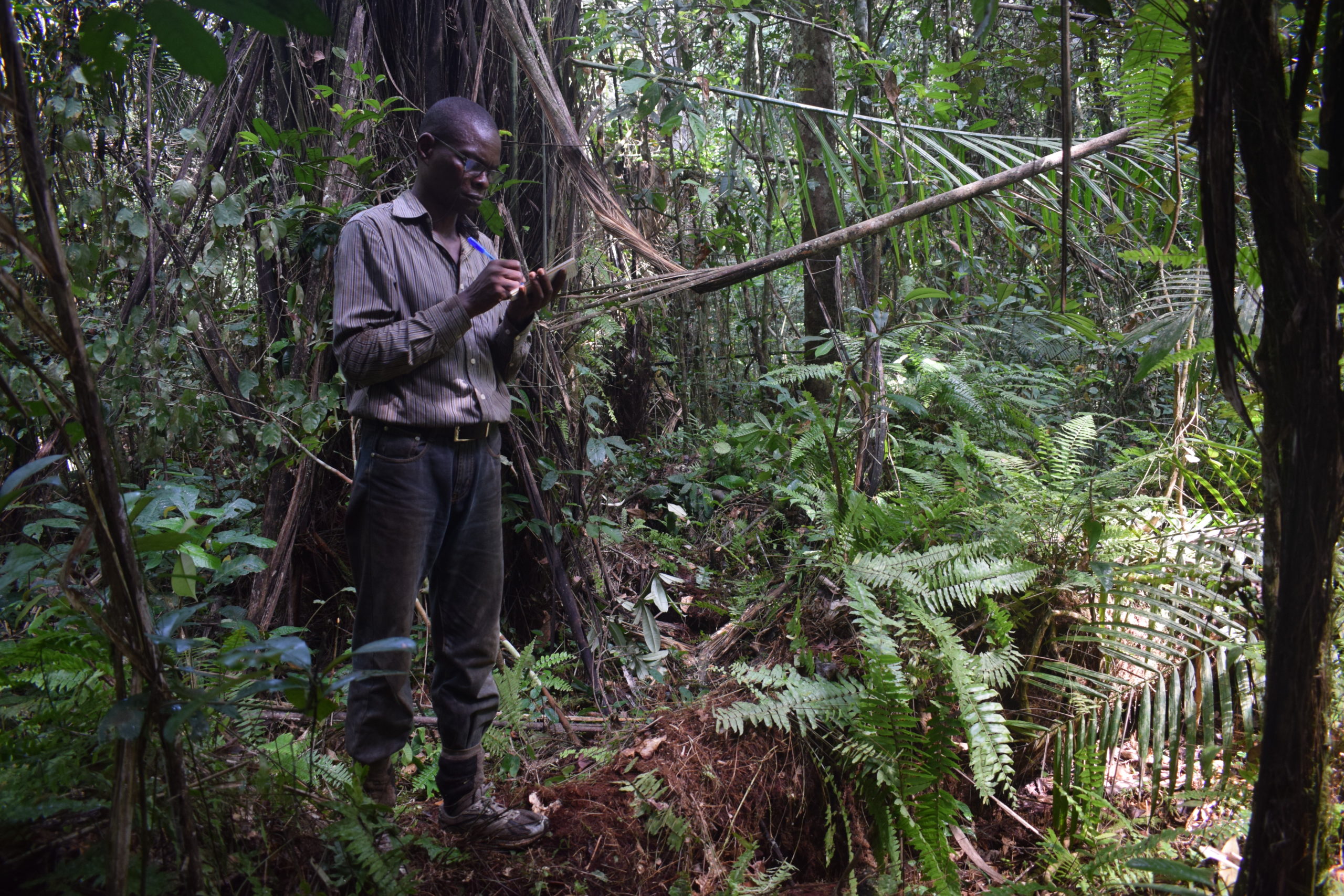
Main image: Prof Corneille Ewango of the University of Kisangani, DRC, takes notes in a peat swamp forest along the Ikelemba River in DRC. Credit: Bart Crezee.
